Bhutan is a landlocked country located on the southern ranges of the great Himalayan Mountain ranges. It is separated from Nepal by the Indian State of West Bengal, with China to the north, and India on the south as well as eastern boundaries.
Its total area is 38,394 km² and falls on the geographic coordinates of 27 30 N, 90 30 E. Bhutan has a wide elevation range from 100msl to as high as, Himalayan peaks over 7000 msl(meters above sea level).
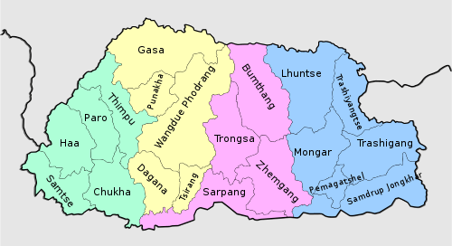
Bhutan is divided into four main geographical areas. Western Bhutan, Central Bhutan, Eastern Bhutan and the southern belt bordering India.
It is further divided into 20 districts or locally referred to as Dzongkhags (State governing body of the district), popular ones among tourists being Paro, Thimphu, Punakha and Bumthang.